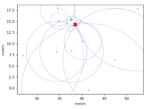
Regarding asset tracking solutions, there are a plethora of systems to choose from. However, one of the many characteristics to consider when making your selection is the underlying location technology, and–especially for the uninitiated–that’s where things can get very confusing. In this post, we’re going to attempt to shed some light on this by discussing four fundamental location techniques: Time of Flight (ToF), Time Difference of Arrival (TDoA), Angle of Arrival (AoA), and Received Signal Strength (RSS).
Join the AirFinder Difference!
- Innovation. Organizations can be freed up to innovate and bring more impactful products and services to market.
- Profitability. Increased profitability provides new opportunities to innovate and improve valuation.
- Digital Transformation. Discover competitive advantages, new revenue opportunities, improved customer relationships, and increased efficiency.
What is Time of Flight?
Time-of-Flight is a highly accurate indoor positioning method that measures distance by calculating the time it takes for signals to travel between devices. This technology is in wide use today; GPS, for example, is a Time-of-Flight based system.
‘Classical’ ToF utilizes wide-bandwidth signals and precise timing to measure ranges down to the centimeter–but at a cost. These systems are among the most costly options for RTLS deployments, so they’re best suited for applications where high precision is absolutely required and expense is not a factor.
Alternatively, ToF can be implemented by using a technique known as “Multi-carrier Phase Ranging.” In this approach, a tag and beacon measure the round-trip phase of a tone at several different frequencies, then use that information to deduce the time of flight, and, subsequently, the range. The advantage of this approach is that it is very low cost and low power (since it can use off the shelf BLE radios). Link Labs is a pioneer in this space: our OnSite XLE system is a phase-based ranging solution built on low-cost hardware.

What is Time Difference of Arrival?
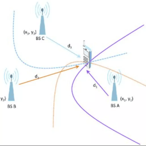
Time Difference of Arrival (TDoA) is similar to ToF in that it is time-based, but rather than measuring ranges to individual beacons, the tag measures the difference in ranges to pairs of beacons. For example, instead of ‘I believe I am 5m from beacon A,’ the tag determines, ‘I think I am 2m closer to beacon A than I am to beacon B.’ While this may seem like a minor difference, it has a significant benefit: these range differences can be measured without tags and beacons forming any connection.
Since this is an entirely one-way transaction, thousands of tags in the same area can simultaneously determine their location without interfering. Depending on the specific implementation, this technique enables high-speed, low-power positioning because the tag acquires enough information for a fix in one shot.
The primary challenge for TDoA systems is time synchronization: for the range differences to have meant the beacons/anchors must be synchronized down to the picosecond–no easy feat. In practice this is often accomplished by distributing clocks to each node via a cabled connection, which greatly increases installation cost and complexity.
Link Labs is currently researching a phase-based TDoA technique that doesn’t require time synchronization; we’re still in the early stages of R&D, however, so stay tuned!

What is Angle of Arrival?
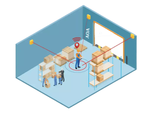
AoA is a positioning technique that can determine the transmission angle between a mobile asset, such as a tag, and a sensor with a multi-antenna array. The relative phase shift of the signal received at each antenna element is used to calculate the angle of the transmitting mobile device. If sufficient receivers see the mobile device its location can be estimated via triangulation. While indoor positioning via AoA can be more accurate than simple signal strength approaches, solutions that leverage this technique are only just entering the market, and the custom antenna arrays required mean they can be costly.

What is Received Signal Strength (RSS)?
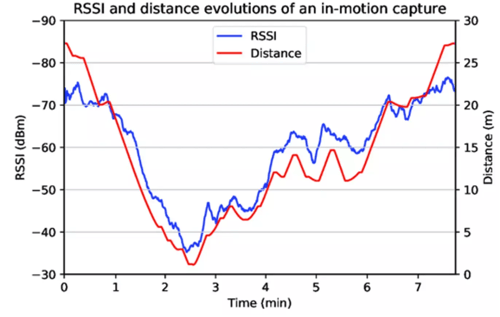
Received Signal Strength measures packets of signal energy. Multiple receiving nodes scan for transmissions from the asset to be located, and the location of the receiver node that reports the highest RSS is considered the estimated location of the asset. The advantage of this method is that it can be implemented efficiently on low-cost, battery-powered tags with small memory sizes and low processing capabilities.
However, the location-estimation accuracy of this method can be inadequate for many applications, as the number of possible ‘locations’ is equal to the number of receiving stations. Adding more receivers can improve the location granularity, but increases the cost of the system since these receivers need some ‘backhaul’ method to transmit observations to a central location. Link Labs patented OnSite BLE system avoids this problem entirely by “flipping the link”: OnSite BLE tags listen for advertisements from low-cost BLE beacons, calculate their own location, then connect to dedicated Access Points to uplink their location. This makes adding more locations to the system significantly lower-cost than conventional systems.

How to Find the Best Asset Tracking System for Your Company?
Many different techniques can be used to measure the location of an asset. Each of the four mentioned in this blog has multiple vendors and variations. However, for most users, battery life and accuracy are the most important considerations when selecting a location technology. At Link Labs, we focus on combining multiple positioning technologies into our networks to provide the best performance to our end users. Please book a demo if you want to learn more about Link Labs and our AirFinder systems.


